

Oxford transportation board makes recommendations for new trail segment after mixed public feedback
After a three-year pause, Oxford is once again making plans to complete the northwest segment of the Oxford Area Trail System.
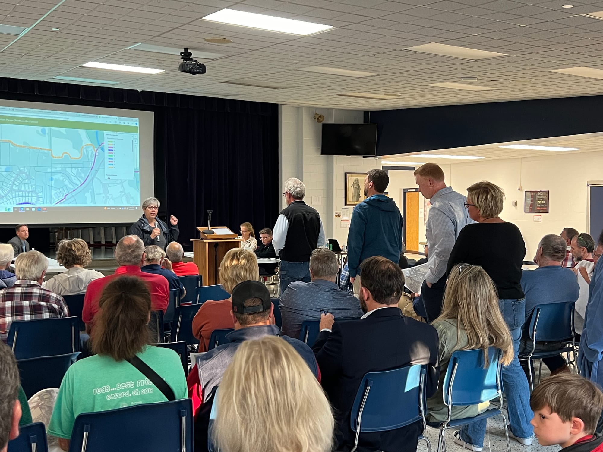
More than a dozen residents spoke for and against several future proposals for the northwest corridor of the Oxford Area Trail System (OATS) during a public meeting Oct. 10.
The meeting, held by Oxford’s Parking and Transportation Advisory Board, focused on how to complete the OATS loop around Oxford. While the city has made progress on eastern and southern portions of the trail, progress on the northwest segment to cross Route 27 and connect the Oxford Community Park to the Black Covered Bridge stalled in 2021. The pause came after several property owners voiced concerns ranging from property values to connecting low-income and high-income neighborhoods.
Oxford contracted with Bayer Becker to develop new proposals for how to align the northwest trail segment. Assistant City Manager Jessica Greene said the OATS is heavily grant-funded. The earliest the city would apply for grants for the northwest segment would be summer 2025, but it’s more likely the city will wait until summer 2026, meaning construction wouldn’t begin until 2028 or later.
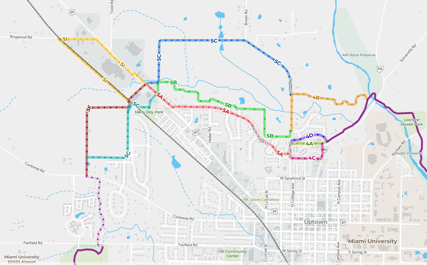
Etta Reed, president of Bayer Becker, attended the Oct. 10 meeting and broke down potential alignments for the new segment. The city considered several options to connect Contreras Road to Route 27, Route 27 to Brown Road and Brown Road to the Black Covered Bridge.
After discussion, the board moved to recommend a path that will lead north of Contreras road just west of Knollwood Drive, turn east behind the houses on Savannah Drive, run north behind Olde Farm Road and cut across the railroad near Merry Day Park to travel along Reaghs Way. The trail will then cross Route 27 at the existing crosswalk and continue southeast to Hester Road, then follow Hester Road, Jacob Drive and Northridge Drive to Brown Road. From there, the planned route will require easements to pass south of Hawks Landing and north of TriHealth Priority Care to reach Morning Sun Road, where existing sidewalks will be improved to finish the trail.
The board recommendation does not determine the final route. The path still needs approval from City Council, and specific details would be worked out in the engineering phase of the project.
Roughly 50 members of the public attended the meeting, and 16 offered their thoughts on the proposals during public comment. Several spoke against the route between Contreras Road and Route 27 which was ultimately chosen — route 5G on the proposal — many citing privacy concerns. Mike Pearson, a resident of Savannah Drive, said the route would lead directly behind his home.
“The reason I moved there in 2009 was because of that field in back of me — total privacy,” Pearson said. “I don’t want a pathway 10 feet off my backyard. I would be totally opposed.”
The proposed routes behind houses would incorporate vegetation buffers in an attempt to preserve privacy, Reed said during her presentation of the options. Rob McCarrick, a resident of Country Club Drive, said he supported the route and would use it often if constructed.
Other residents highlighted safety concerns for the stretch along Hester Road and Northridge Drive, labeled as route 5A on the map at the meeting. Multiple people said drivers constantly cut through stop signs and speed on those roads.
Adam Beissel, a resident on Honor Lane, said he counted 70 driveways that would back onto the 5A trail section. He was also opposed to trail additions that would cut into people’s front yards. The board officially recommended a version of the 5A section which involves replacing existing sidewalks with an 11-foot multimodal path, though it could be developed more cheaply as a “sharrow” where pedestrians use the sidewalk and bikers share the street with cars.
“My biggest concern is if we widen that sidewalk,” said Christine Pacewicz, a homeowner on Northridge Drive. “If we put that bike path where we’re always backing out, I’m thinking about having kids, and if they run out, they can get sideswiped by a bike … I’m opposed to it being on a bigger sidewalk by us.”
Jim Vinch, a cyclist who recently moved to Oxford, said he’s excited to see the trail system expanded because it will provide increased safety for cyclists. Every time he bikes on the roads in Oxford, Vinch said he gets run off the road by drivers. Vinch said he feels that the community is too hostile both to bikers using the road and to the idea of bike paths like the OATS.
“I feel like every day when I’m out on my bike, I put my life on the line … I can’t win,” Vinch said.
This summer, the city completed Phase Three of the OATS connecting Peffer Park to Talawanda High School. An additional section connecting Talawanda Middle School to Oxford Community Park is almost complete, and Oxford has secured some funding for a connection between the two schools which will include a pedestrian bridge over the railroad.


